Purpose:
The purpose of this document is to help educate the cruise ship tender operators to the standard operating procedures of Lahaina Harbor. This document is also intended to familiarize the operators to the local weather related hazards of Lahaina Harbor. The Maui HOST Committee has endorsed this document.
This document must be reviewed by the tender vessel operators prior to each port of call to Lahaina Harbor. The briefing should take place within 24 hours of arrival to Lahaina Harbor.
Definition of terms:
Safe Water Buoy – a “Safe Water Buoy” is vertically stripped buoy, which is red and white in color. This buoy indicates safe water all round the buoy.
“L” Buoy – is a “Safe Water Buoy” that marks the entrance to Lahaina Harbor.
Channel markers – are red (Nun buoys) and green (Can buoys) that mark the Lahaina Harbor entrance channel. The common “Red Right Returning” rule applies here. This means that the Red Nun Buoys will be on your starboard side when inbound to the harbor.
Range markers – are red with a white vertical strip down the middle. These markers are located on shore, in line with the channel. When the two ranges are lined up your vessel will be in the middle of the channel.
Range Light – these are fixed green lights attached to the top of the Range Markers. These lights serve the same purpose as the Range Markers, except they are used as night navigational aids.
VTC – This stands for “Vessel Traffic Coordinator.” All vessel traffic is controlled by the VTC. The VTC is a DLNR-Boating official, or is appointed by DLNR to act on their behalf. Communication between the VTC and the Tender Operators will be through the Cruise Ship Shore Side Officer.
Preparation for Entering Lahaina Harbor:
The entrance to Lahaina Harbor is indicated by a lighted, Red and White buoy – A Safe Water Buoy. This is indicated on the chart as RW “L” Mo (A). This buoy is locally referred to as the “L” Buoy (see fig. #1).
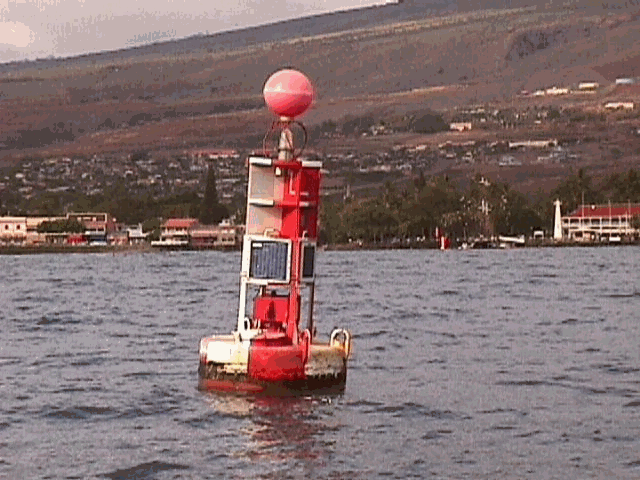
Figure #1
All tender vessels need to use this buoy as their target in preparation for entering Lahaina Harbor. Once the tender vessel approaches the “L” Buoy the operator will be able to see the channel buoys (see fig #2), and Range Markers (see fig. #3) clearly.
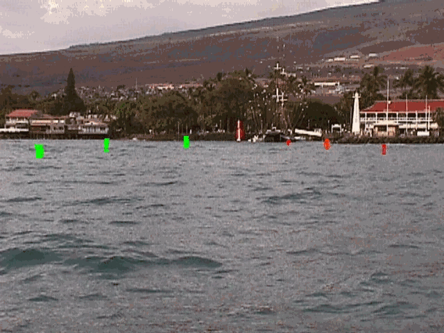

Figure #2 Figure #3
The tender vessel operators should pass the “L” buoy on their port side when entering Lahaina Harbor (see fig #4).

Figure #4
Entering Lahaina Harbor:
Entrance into Lahaina Harbor is by permission from the VTC only. The Tender operator will call the Cruise Ship Shore Side Officer to seek permission to enter Lahaina Harbor. The Cruise Ship Shore Side Officer will than ask permission from the VTC. Once the VTC gives permission to enter Lahaina Harbor, the tender vessel operator must be in position and ready to proceed. It is important that the tender vessel operator be lined up on the range markers/lights (see fig. #3 day view, figure #5 night view) before proceeding.
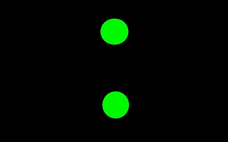

Figure #3 Figure #5
Figure #6 and #7 are night views of NOT being lined up correctly with range lights. This will cause you to go aground.


Figure #6 – Offset to the north of channel
Figure #7 – Offset to the south of channel
Once permission is granted and the vessel is lined up on the Range markers/lights the operator can proceed down the Range and into the marked channel (see fig. #2).

Figure #2
Tender vessels will be assigned to tie-up at the “North” side of the loading dock at Lahaina Harbor (see fig #8).
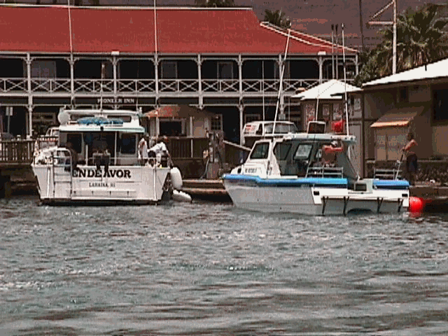
Figure #8
The VTC will ensure that tender operators will either reduce their prop-wash, or redirect it away from the harbor entrance. Tender operators are asked to BE AWARE of other vessel traffic. Lahaina harbor is a small, but very busy harbor. There will be other vessels using this harbor at the same time. Be courteous, and follow the VTC’s instructions.
Exiting Lahaina Harbor
Permission to exit Lahaina Harbor must also be given from the VTC. Again, this is of utmost importance, as the other commercial vessel will be using the VTC to coordinate their movements as well. We all must operate off the same process. Once permission is granted to depart Lahaina Harbor, the tender vessel operator will need to turn 180 degrees at the first available point (at the Brig Carthaginian’s stern). Once the turn is complete the operator can proceed outbound of the channel, keeping the green “Can buoys” on your starboard side. At the point where the tender vessel passes the #1 green “Can buoy” (starboard side), the #2 red “Nun buoy” (port side), the operator should make way to the “L” buoy, keeping it on your port side (see figure #9).
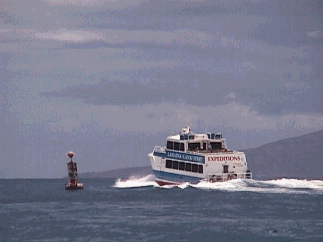
Figure #9
Weather Related Concerns:
The three greatest weather related hazards for Lahaina Harbor are wind, current, and swell. All of which have some sort of effect on the maneuverability of your vessel.
Wind:
The prevailing wind, or normal trade wind pattern is out of the East, Northeast. The strength of this trade wind varies greatly. All tender vessel operators should receive an updated local weather report from the bridge of the ship prior to commencing operations.
Kona winds, or southerly winds can be of great concern to the tender vessel operator. These winds occur during the winter months in the Hawaiian Islands. Kona winds precede a strong low-pressure system. The normal trade winds will veer, and become southerly. These winds can become very strong (from 15 knots – 50 knots) depending on the severity of the low-pressure system. During Kona conditions it will important to check with the Harbor Master prior to commencing operations.
Current:
The anchorage can experience some very strong currents. The typical anchorage current speed is between 0.5 knots and 1.0 knot. There are; however, times when the currents will exceed the normal. At these times you can expect currents to be between 1.0 knots and 3.0 knots. The current direction will travel along the coastline to the north and to the south. Beware that the currents in this area may not always change after slack tide. We have seen the current run in the same direction for several days (north current – slack tide – north current again).
During times of large swell there can also be currents in the Lahaina Harbor channel. So, the tender operators should monitor the currents. When entering the channel during times of large swell the current will pull your vessel into the break-wall along the south edge of the channel. When setting up to enter the channel on large swell days, it is advisable to stay father to the north side of the channel to help limit the pull into the break-wall.
Swell:
The swell will be the most dangerous of the all the weather related conditions that the tender operator will experience. This is because it may be a beautifully calm day, and every 10 minutes or so, a large ocean swell moves through the area. If taken by surprise a vessel can broach in the channel. TIMING IS EVERYTHING when operating in a large swell. The operator must take their time. The timing of when the sets come through is important to know and understand, because you want to make your run down the channel during the lull, in-between sets. Your VTC should be able to inform you of what the timing interval is; HOWEVER, it is the operators responsibility to be cautious.
Also beware that on large swell days there are many surfers in the area. The tender vessels will be utilizing the north side of the loading dock, so the probability of have surfer jump off into the water there is unlikely. Keep in mind that the surfers sometimes use the channel to make their way back out offshore. Figure #10 shows a surfer in the critical turning zone at the inside end of the channel. Notice the vessel in the background is tie-up to the north side of the loading dock (that will be your vessel when you are in port).
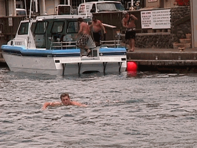
Figure #10
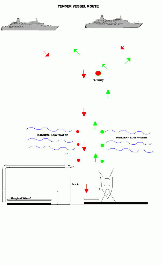
Figure #11 below is a diagram of the suggested tender vessel routes depending on whether the cruise ship anchored north or south of the “L” Buoy:
Comments and Suggestions Appreciated. A special thanks goes to Jim Walsh of Maui for putting this together for H.O.S.T. to be able to post on its Web Site
